Mussel Rock paragliding conditions. Daly City, California, Monday 14 September 2026, 03:40 PDT.Night
Whether Mussel Rock is flyable, hour by hour for the next seven days: the meter on the cliff, four forecast models and one verdict for every daylight hour. Today: fly from 14h to 20h, WNW 10 to 12 mph, 4 of 4 models agree.
Free, no account, refreshed every 10 minutes from the meters on the cliff.
- Walker SW to NW
- Lemmings SW to NW
- Tomcat W to NNW
- Coyote SSW to W
- The Perch SSW to NW
- Green Monster SSW to NNW
- The Jungle SW to WSW
- Cheetah SSW to W
Point at an hour on the right: the needle turns to its wind and the launches that take it light up. The orange arc is the site's whole window, SSW to NNW.
The next 48 hours
HRRR every hour, the model the pilots' dashboard runs, wind at 10 m over Walker Launch. The line is the mean, the dashes the gusts, the shade the 9 to 19 mph band. Orange dots: the same model corrected against the cliff meter's own history by musselrockwx.com.
- 0h5gusts 7W, night
- 1h4gusts 4WSW, night
- 2h5gusts 7WSW, night
- 3h5gusts 6WSW, night
- 4h5gusts 8SW, night
- 5h6gusts 7SW, night
- 6h6gusts 7SW, night
- 7h6gusts 7SW, too light
- 8h4gusts 6SW, too light
- 9h5gusts 6WSW, too light
- 10h6gusts 6W, too light
- 11h6gusts 76 of 8W, light, Walker, Lemmings, Coyote, The Perch, Green Monster and Cheetah
- 12h8gusts 97 of 8W, light, Walker, Lemmings, Tomcat, Coyote, The Perch, Green Monster and Cheetah
- 13h9gusts 115 of 8W, light, Walker, Lemmings, Tomcat, The Perch and Green Monster
- 14h10gusts 135 of 8WNW, clean, Walker, Lemmings, Tomcat, The Perch and Green Monster
- 15h11gusts 165 of 8WNW, clean, Walker, Lemmings, Tomcat, The Perch and Green Monster
- 16h12gusts 175 of 8WNW, clean, Walker, Lemmings, Tomcat, The Perch and Green Monster
- 17h12gusts 175 of 8WNW, clean, Walker, Lemmings, Tomcat, The Perch and Green Monster
- 18h12gusts 185 of 8WNW, clean, Walker, Lemmings, Tomcat, The Perch and Green Monster
- 19h12gusts 175 of 8WNW, clean, Walker, Lemmings, Tomcat, The Perch and Green Monster
- 20h12gusts 18W, night
- 21h12gusts 17W, night
- 22h12gusts 17W, night
- 23h11gusts 16W, night
- 0h10gusts 15W, night
- 1h10gusts 15W, night
- 2h10gusts 15WNW, night
- 3h10gusts 17WNW, night
- 4h9gusts 14W, night
- 5h10gusts 14W, night
- 6h10gusts 14W, night
- 7h9gusts 147 of 8W, clean, Walker, Lemmings, Tomcat, Coyote, The Perch, Green Monster and Cheetah
- 8h10gusts 136 of 8W, clean, Walker, Lemmings, Coyote, The Perch, Green Monster and Cheetah
- 9h11gusts 136 of 8W, clean, Walker, Lemmings, Coyote, The Perch, Green Monster and Cheetah
- 10h11gusts 136 of 8W, clean, Walker, Lemmings, Coyote, The Perch, Green Monster and Cheetah
- 11h12gusts 146 of 8WSW, clean, Walker, Lemmings, Coyote, The Perch, Green Monster and Cheetah
- 12h13gusts 166 of 8WSW, clean, Walker, Lemmings, Coyote, The Perch, Green Monster and Cheetah
- 13h13gusts 166 of 8WSW, clean, Walker, Lemmings, Coyote, The Perch, Green Monster and Cheetah
- 14h14gusts 176 of 8WSW, clean, Walker, Lemmings, Coyote, The Perch, Green Monster and Cheetah
- 15h15gusts 196 of 8WSW, clean, Walker, Lemmings, Coyote, The Perch, Green Monster and Cheetah
- 16h16gusts 206 of 8WSW, clean, Walker, Lemmings, Coyote, The Perch, Green Monster and Cheetah
- 17h17gusts 226 of 8WSW, clean, Walker, Lemmings, Coyote, The Perch, Green Monster and Cheetah
- 18h15gusts 206 of 8WSW, clean, Walker, Lemmings, Coyote, The Perch, Green Monster and Cheetah
- 19h15gusts 206 of 8W, clean, Walker, Lemmings, Coyote, The Perch, Green Monster and Cheetah
- 20h14gusts 19WSW, night
- 21h14gusts 19WSW, night
- 22h14gusts 20WSW, night
- 23h14gusts 20SW, night
Corrected is Mike Fifield's musselrockwx.com feed: HRRR rescored every hour against what the Mussel Rock station actually read on days like this one. Its error on the cliff wind is 2.6 mph against 3.7 for the raw model at 0 to 12 hours, so where the dots sit under the line, trust the dots.
What the meters read
The cliff station is the one that decides. The others say what is coming: Fort Funston shows the upper wind, Sharp Park the sea-level wind, the buoy the ocean, the airports the deck.
Mussel Rock, Longview Drive
488 ft, cliff top; in rotor when the wind is southgusts 11 mph, 55°F, read 1 min ago
Fort Funston
200 ft, the upper wind, 5 km northgusts 13 mph, 57°F, read 15 min ago
Sharp Park beach, Pacifica
20 ft, sea level, 4 km southgusts 6 mph, 57°F, read 20 min ago
Buoy 46026
20 miles off the Golden Gatewaves 5.2 ft, sea 60.1°F, read 30 min ago
Half Moon Bay
the airport METAR, the deck down the coastceiling 900 ft, visibility 4 mi, 10:15 UTC
KSFO
the airport METAR, the deck over the Bayno ceiling, visibility 10+ mi, 10:00 UTC
Tide at the beach
NOAA station 9414290, Golden Gateabove 5 ft the beach under the cliff is narrow
Daylight
sunrise and sunset at the cliffthe afternoon is when the wind is there: noon to sunset
The week
One tile per day: fly, maybe or no, the window, and how many of the models agree. Fly needs two hours in a row inside the arc and the band with no fog on the rock.
- Today14 SepFly14h to 20hclean4 of 4 models
- Tuesday15 SepFly7h to 20hclean4 of 4 models
- Wednesday16 SepFly7h to 20hclean3 of 3 models
- Thursday17 SepFly14h to 20hclean2 of 3 models
- Friday18 SepFly14h to 20hclean3 of 3 models
- Saturday19 SepFly7h to 20hclean3 of 3 models
- Sunday20 SepFly7h to 15hclean2 of 3 models
The launches
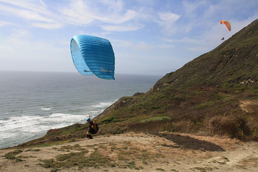
Eight launches on one cliff, each with its own slice of the wind. The arc is drawn on each one; the needle is the wind at the cliff meter right now.
- not this wind
Walker230 ft
The main launch, north of the parking, a 400 m walk. Takes wind from SW to NW.
- not this wind
Lemmings200 ft
Just south of Walker, lower on the cliff. Takes wind from SW to NW.
- not this wind
Tomcat260 ft
The southern launch above the parking. Takes wind from W to NNW.
- not this wind
Coyote400 ft
Above Walker, where the Coyote wind meter stands. Takes wind from SSW to W.
- not this wind
The Perch387 ft
From the back side of Coyote, left of the bench. Takes wind from SSW to NW.
- not this wind
Green Monster
The high green face between Lemmings and Coyote. Takes wind from SSW to NNW.
- not this wind
The Jungle
The brushy launch that only takes a south-west wind. Takes wind from SW to WSW.
- not this wind
Cheetah500 ft
South of the parking, where the Cheetah camera looks WNW. Takes wind from SSW to W.
How the verdict works
Five checks, in the order a pilot makes them on the cliff. Every hour of every model goes through them; a day is the best run of hours that came out clean.
Off the sea
The wind has to come from between SSW and NNW, 202° to 337°. Anything else is over the back of the ridge or along it, and the launches are in rotor.
In the band
9 to 19 mph at 10 m reads as fly. 6 to 9 is light and 19 to 22 is strong: both are maybe. Under 6 or over 22 is no. The cliff top reads 5 to 7 mph more than the launches.
No fog on the rock
Low cloud at 80 % or more with visibility under 3 km is fog on the launch, and the hour is out. A deck above the cliff only makes it maybe.
Gusts and rain
A gust 10 mph over the mean turns a fly hour into maybe. Showers at 30 % do the same; rain at 50 % or more is no.
Two hours in a row
A day is fly when two consecutive daylight hours come out fly, maybe when two come out fly or maybe. Every model votes; the tile shows the majority and the count.
Questions before you drive
FreeThe page is rebuilt every 10 minutes on a small server from public feeds, and it costs nothing to keep that way. No account, no app, no cookie.
Is this the official site status?
No. It is a forecast read against the rules the local schools teach. The site is run by the Fellow Feathers club and the Mussel Rock Park rangers; a closure, a ranger call or a school's own no overrides anything here.
Do I need a rating to fly here?
Mussel Rock is a P2 site with a site intro. Visiting pilots fly it through Paragliding San Francisco or Airtime of San Francisco, the two schools on the cliff, who give the intro and lend a radio on 147.495 MHz.
What if the fog is in?
Fog over the water is normal and pilots fly under it. Fog on the launch itself is the only fog that stops flying: you cannot see the beach or the sock. The forecast marks an hour no when low cloud is 80 % or more with visibility under 3 km.
What does too strong look like?
Above 19 mph at 10 m the pilots' dashboard turns amber and above 22 it turns red. The lower launches, Walker and Lemmings, take a wind the top of the cliff would refuse, which is why the launches are listed with their own arcs.
Does the tide matter?
Only for the landing: at a high tide above 5 ft the beach under the cliff is narrow, and the landing is the parking lot or the field. The next tides are in the meters above.
How high can I go?
The ceiling over Mussel Rock is 1,600 ft under the San Francisco Class B shelf. On a strong day the ridge lifts you there in minutes.
Where do the numbers come from?
HRRR, GFS and ECMWF through Open-Meteo, the National Weather Service hourly grid, the Weather Underground stations on the cliff through musselrockwx.com, NDBC buoy 46026, the KSFO and KHAF METARs and the NOAA tide station at the Golden Gate. Every feed is public and named at the foot of the page.
Today reads fly, 14h to 20h. Check the sock when you get there.
- Forecast models: Open-Meteo (HRRR, GFS, ECMWF, CC BY 4.0) and the National Weather Service
- Corrected forecast and cliff meters: musselrockwx.com, built by Mike Fifield, Weather Underground stations KCADALYC1, KCASANFR69 and KCAPACIF205
- Ocean and airports: NDBC buoy 46026, aviationweather.gov METARs, NOAA tides 9414290
- Site rules: Paragliding San Francisco, Airtime of San Francisco, Fellow Feathers
- Photograph: Matthew Keys, CC BY-SA 4.0
